
Pérou
Fiche d'identité
Capitale
Lima Superficie cafeière
425 416ha Superficie moyenne des fermes
3,5ha Géographie
Peru is located in the central and western part of South America (UTM N7970840.422; E552505.422; ZONE 18). It has a continental surface area of 1,285,216.60 km², which represents 0.87% of the planet, distributed as follows: coastal region 136,232.85 km² (10.6%), Andean region 404,842.91 km² (28.4%) and Amazon region 62% (782,880.55 km²). 880.55 km² ); the northern end of the Peruvian territory is at the Putumayo River at 0°02'00" south latitude, the southern end is at the seashore in Tacna (La Concordia point) at 18°21'03" south latitude; the eastern end is at the Heath River in Madre de Dios at 68°39'00" east longitude and the western end is at Caleta Punta Balcones in Pariñas, Talara, Piura at 81°19'35".
The Peruvian Sea or Sea of Grau is the part of the Pacific Ocean that extends along the Peruvian coast for an extension of 3080 km.1 and a width of 200 miles offshore. Its great ichthyological richness is the result of the Humboldt and El Niño sea currents. Its sovereign sea has a maritime area of 991,194.97 km², being a country with a great hydrological potential.
The highest peak in Peru is the Huascaran in the Cordillera Blanca, with an altitude of 6768 masl; the lowest area is the Sechura depression at -34 m.b.a.s.l. the deepest valley is the Cotahuasi Canyon, even surpassing the famous Colorado Canyon; the longest river in Peru is the Ucayali River (tributary of the Amazon River with 1771 km in length; the highest navigable lake in the world is Lake Titicaca in Puno/Peru with 8380 km² and the largest island of the Peruvian coast is the San Lorenzo Island in Callao with 16.48 km². It is the third largest country in South America.
Geologically, Peru is a young country in most of its territory. Forty-two percent of its surface, the Andean system and the coast, arose in the Mesozoic Era, between 130 and 65 million years ago, as a result of tectonic uplifts caused by the subduction of the Nazca plate into the South American plate.
It rises over a territory affected by subduction of the Nazca oceanic plate under the South American continental plate. The intensity of the clash between both masses produced, from the Tertiary Era onwards, the Andes mountain range, a spectacular and practically unique mountain system that structures the country in three very different geographic regions: coast, highlands and jungle.
Période de récolte
Mai - Novembre Nombre de caféiculteurs
230000 Nombre de personnes vivant de l'industrie du café
890000 Nombre de récolte par an
1 Production de sacs par an
4000000 Variétés principales
Bourbon, Catimor, Catuai, Caturra, Pache, Typica
Zones de production caféiere
Cliquez sur la zone que vous souhaitez observer
Amazonas
La région Amazonas est l'une des 24 régions qui compose le Pérou. Située tout au Nord et frontalière à l'Equateur, ce terroir abrite un écosystème très riche, des jungles basses et hautes "les Yungas", des écosystèmes andins et une forêt tropicale sèche. C'est tout de même une forêt tropicale humide qui prédomine le territoire à plus de 70%, elle s'étend de l'Equateur jusqu'aux sommets de la Cordillera del Condor. Les routes sont sinueuses et peu nombreuses, ce qui ajoute une peu de piment lors du transport de nos chers grains verts. Faune et flore sont riches à l'image de nombreux oiseaux et animaux sauvages endémiques (colibri, puma, opossum, tatou, singe, poisson-chat,...). Malheureusement, cette zone d'Amazonie est pourvue en arbres exploitables pour leur bois comme l'acajou, le cèdre... Encourager les productions sous ombrage et préserver les zones forestières nous semble donc être une priorité pour protéger cette zone unique.
Cajamarca
La région de Cajamarca est située au nord-est du Pérou, dans la région Quechua entre 2 300 et 3 500 mètres d'altitude. Le relief est varié et vallonné, en raison du contraste marqué entre les chaînes de montagnes des Andes occidentales, appelées "Andes del Chamaya" dans cette région, les vallées et les rivières Huancabamba et Marañon.
La région profite d’un des meilleurs climats des départements de la Sierra péruvienne avec un climat tempéré, sec, ensoleillé pendant la journée et frais la nuit. La température moyenne annuelle est de 16 °C, avec une saison des pluies de décembre à mars.
La principale ressource économique est l'agriculture avec des productions de riz, de cacao, de maïs et bien sûr de café. Les plus grandes provinces productrices de café, Jaén et San Ignacio, sont situées entre 900 et 1950 mètres au-dessus du niveau de la mer. On y cultive principalement les variétés Typica, Caturra et Bourbon. Les cafés de Cajamarca se distinguent par leur douceur, leurs notes de fruits rouges et jaunes et leur acidité.
Piura
La région de Piura bénéficie de conditions climatiques favorables à la culture du café. Son climat sec et très nuageux à l'aube permet aux plantations de s'épanouir à l'ombre d'espèces endémiques et d'arbres fruitiers, dans un environnement où l'agroforesterie est très répandue. Le café biologique constitue un produit emblématique de cette région, bénéficiant à plus de 16 000 familles de caféiculteurs exploitant environ 8 350 hectares. Les principales variétés cultivées à Piura sont le catimor, la caturra, la típica, la geisha, le bourbon, le caturi et le pache.
Cette région réunit donc des conditions climatiques et géographiques très propices, permettant à une agriculture familiale d'exploiter diverses variétés de café sous une approche biologique et agroforestière.
San Martin Jilotepeque
San Martín Jilotepeque est une municipalité du département de Chimaltenango. À San Martín, plus de 80 % de la population appartient à des groupes ethniques indigènes, descendants du royaume Kaqchiquel. Ses habitants se consacrent au commerce, à la fabrication d'objets artisanaux, au tissage typique, à l'agriculture et à la culture du café.
Périodes de récolte
Région | Janvier | Février | Mars | Avril | Mai | Juin | Juillet | Août | Septembre | Octobre | Novembre | Décembre |
---|---|---|---|---|---|---|---|---|---|---|---|---|
Amazonas | ||||||||||||
Cajamarca | ||||||||||||
Piura | ||||||||||||
San Martin Jilotepeque |
La filière café du pays
La filière
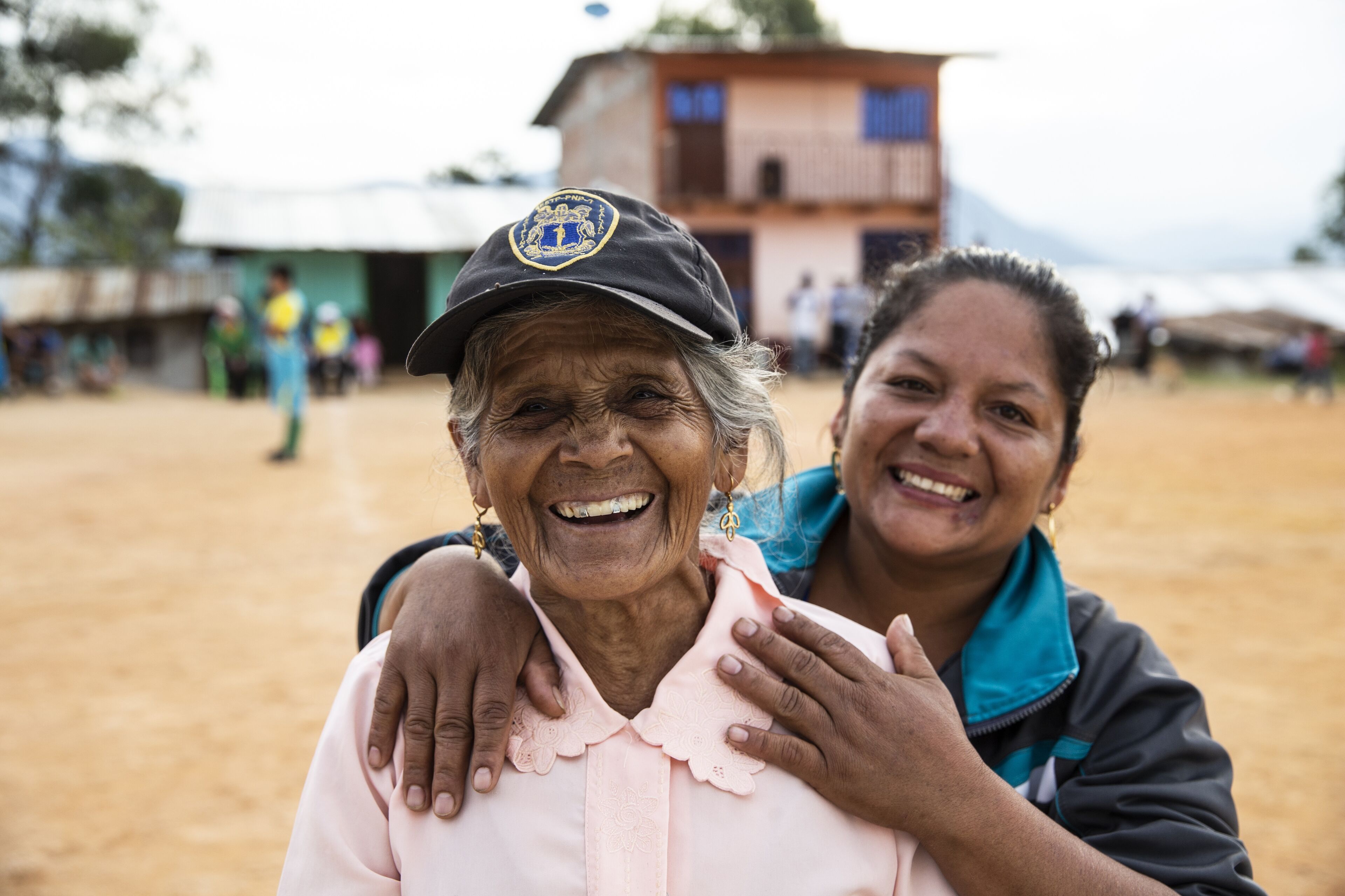
In Peru, coffee is produced in 210 rural districts located in 47 provinces of 10 departments. The area cultivated with coffee occupies 230,000 hectares distributed in three zones, being the most appropriate region to obtain the best yields with high quality the one located in the jungle zone, under a tropical ecology. Eighty-five percent of Peruvian producers have properties that fluctuate between 0.5 and 5 hectares. Coffee grows with relative ease from 600 to 1,800 meters above sea level in almost all geographical regions of Peru. However, 75% of the coffee plantations are above 1,000 meters above sea level. The diversity of combinations of climates, soils, precipitation and sunlight constitute a propitious scenario for the cultivation of coffee. Peruvian coffees are of the Coffea arabica type, with different flavor, aroma and acidity profiles. The varieties of coffee cultivated in Peru are Typica (70%), Caturra (20%) and others (10%). 90% of Peruvian coffee is grown under shade, with an average density of 2,000 plants per hectare. In accordance with current trends, some groups of Peruvian farmers have specialized and work in organic and other specialty coffees, recognized for their profile and peculiar characteristics such as cup quality, acidity and balanced flavor that adjusts very well to the microclimates, temperature and strict altitude.
Geographie
Peru is located in the central and western part of South America. It has a continental area of 1,285,216.60 km², which represents 0.87% of the planet, distributed in coastal region 136,232.85 km² (10.6%), Andean region 404,842.91 km² (28.4%) and Amazon region 62% (782,880.55 km²).
The Peruvian Sea or Sea of Grau is the part of the Pacific Ocean that extends along the Peruvian coast for an extension of 3080 km1 and a width of 200 miles offshore. Its great ichthyological richness is the result of the Humboldt and El Niño sea currents. Its sovereign sea has a maritime area of 991,194.97 km², being a country with a great hydrological potential.
Peru's highest peak is the Huascarán in the Cordillera Blanca, with an altitude of 6768 masl; the lowest area is the Sechura depression at -34 m.b.s.l. the deepest valley is the Cotahuasi Canyon, surpassing even the famous Colorado Canyon; the longest river in Peru is the Ucayali River (tributary of the Amazon River with 1771 km in length; the highest navigable lake in the world is Lake Titicaca in Puno/Peru with 8380 km² and the largest island of the Peruvian coast is the San Lorenzo Island in Callao with 16.48 km². It is the third largest country in South America.
Principaux acteurs
Ministerio de Comercio Exterior y Turismo
Ports d'exportation
Belco, Pérou
The Colombia office and Andean Region (including Peru) was created in 2021. Today, it employs 5 people:
- Diego, General Manager & Sourcing
- Monica, R&D Director
- César, Quality Director
- Maria Silvia, Marketing & Commercial Support Manager
- Kevin, Lab Assistant
Having an agency at the origin is key for Belco. It allows :
- Direct and tailor-made sourcing
- Support for producers in agroforestry, organic transition, processes, etc.
- Improving the quality of locally produced coffees
- The implementation of innovative environmental and social projects.
- Double quality control
Le mot du sourceur
La Colombie reste l’un de principaux pays producteurs de café au monde. Ses terroirs et leurs variétés, étalés du nord du pays (à la frontière avec le Venezuela) jusqu’au sud (à la frontière avec l’Equateur) dans la chaine des trois cordillères, font pratiquement du pays un continent café à lui tout seul. La filière est probablement l’une de plus structurées au monde, avec une Fédération Nationale puissante qui reste le plus grand exportateur et qui distribue aux grandes coopératives de ces différentes régions.
Dans ce contexte, nous focalisons une bonne partie de notre énergie à travailler avec des associations de producteurs, plus petites que les coopératives et certainement moins organisées, mais qui nous donnent un accès direct à des terroirs plus exclusifs et aux caféiculteurs qui les cultivent. Sans exclure les fermes de tailles petites à moyennes, nous travaillons avec elles afin de proposer des cafés fins de plantation et développons avec beaucoup d'effort et de patience des microlots qui reflètent l’identité et le soin mis par ces femmes et ces hommes que les cultivent.
Nous offrons aux torréfacteurs des cafés avec une traçabilité totale, une transparence contextualisée afin de la transmettre au mieux à leurs clients finaux, et d’une qualité exceptionnelle mais pas que en tasse, aussi d'un point de vue de la rémunération du producteur et environnemental. L'agence de Colombie étant la filiale d’un groupe avec une capacité logistique et financière robuste, nous sommes capables de livrer du café dans les 4 coins de la planète.
Angel Barrera
Les producteurs
Esmerida H Pérez
Nicolas Chilcon
Les cafés produits en Pérou

Son nom rend hommage au majestueux Condor des Andes